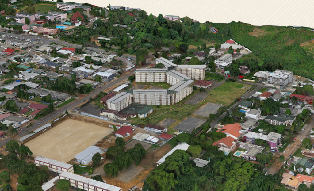
3D scene of Ambassade, Abidjan
PLACE collects very high-resolution aerial and 360 degree street imagery for urban centres in Africa and small island nations in the Caribbean and the Pacific
What does that look like?
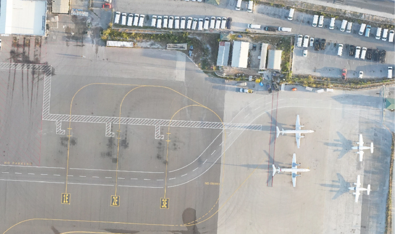
Providenciales International Airport, March 2023
PLACE Aerial
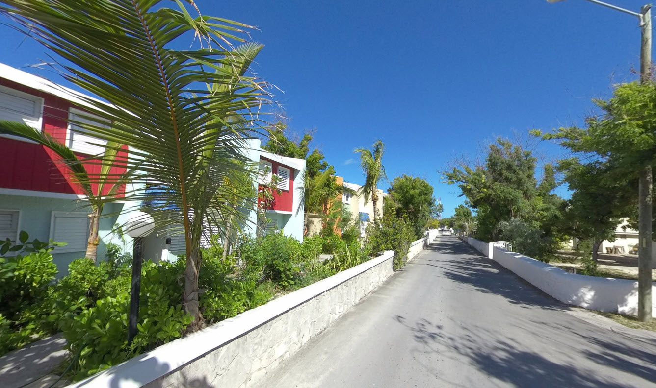
Cockburn Town, Grand Turk, January 2023
PLACE Ground
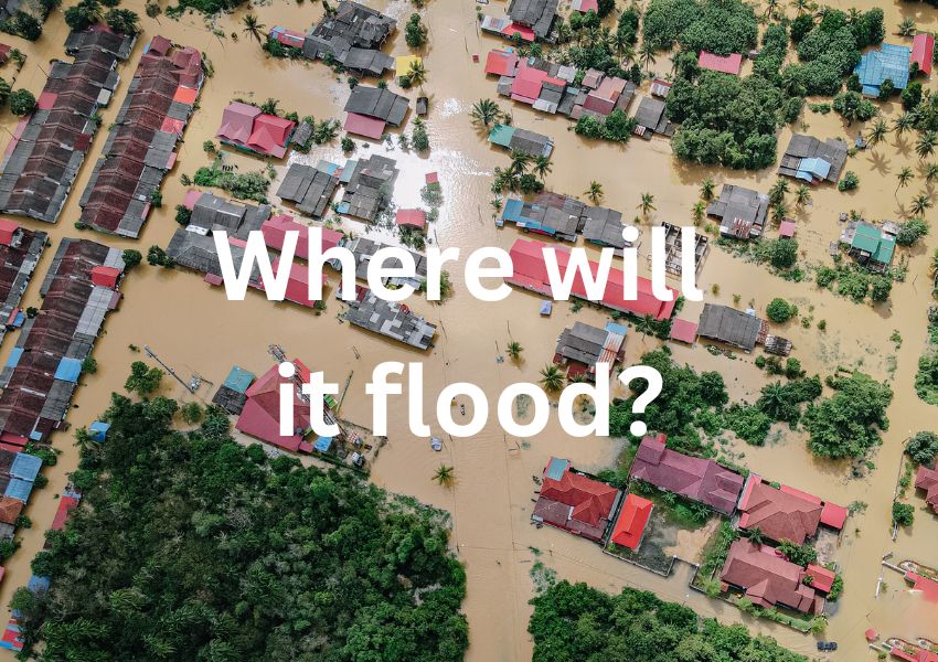
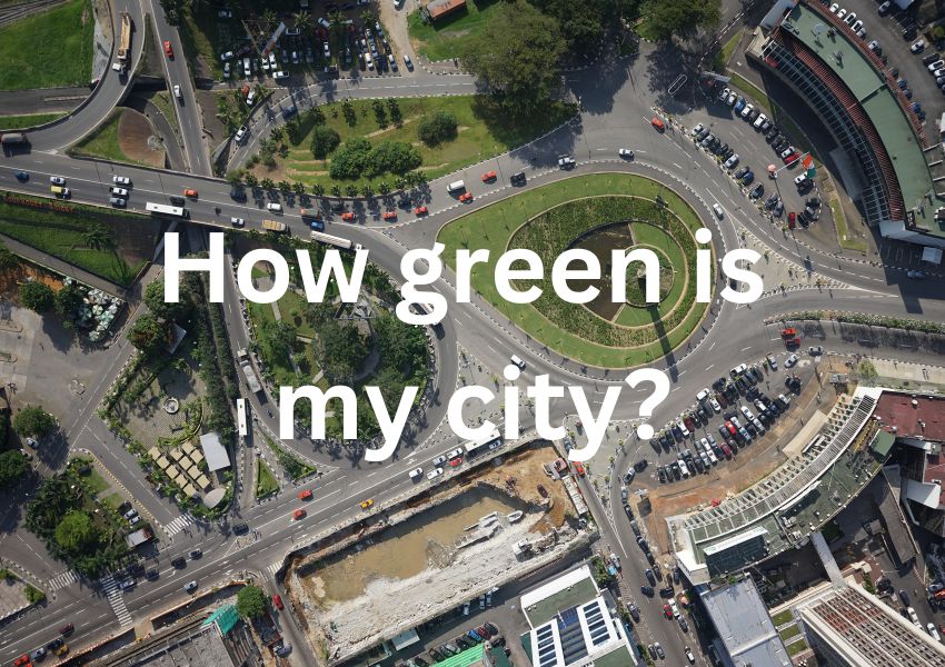
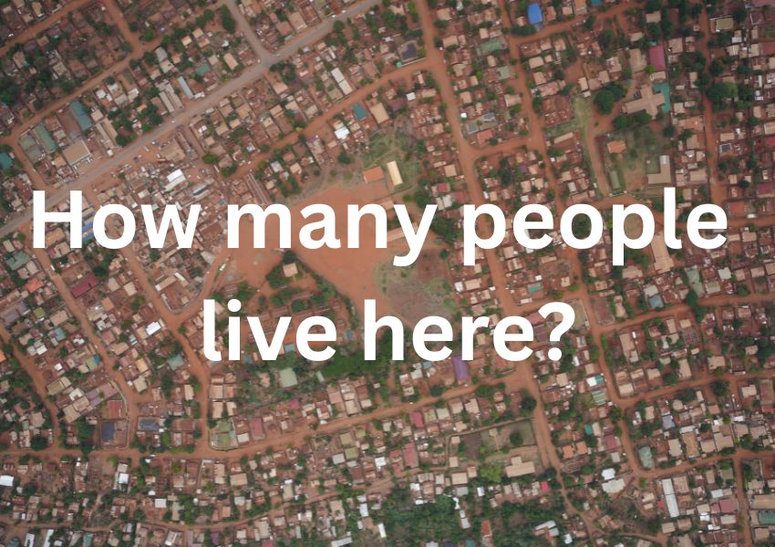
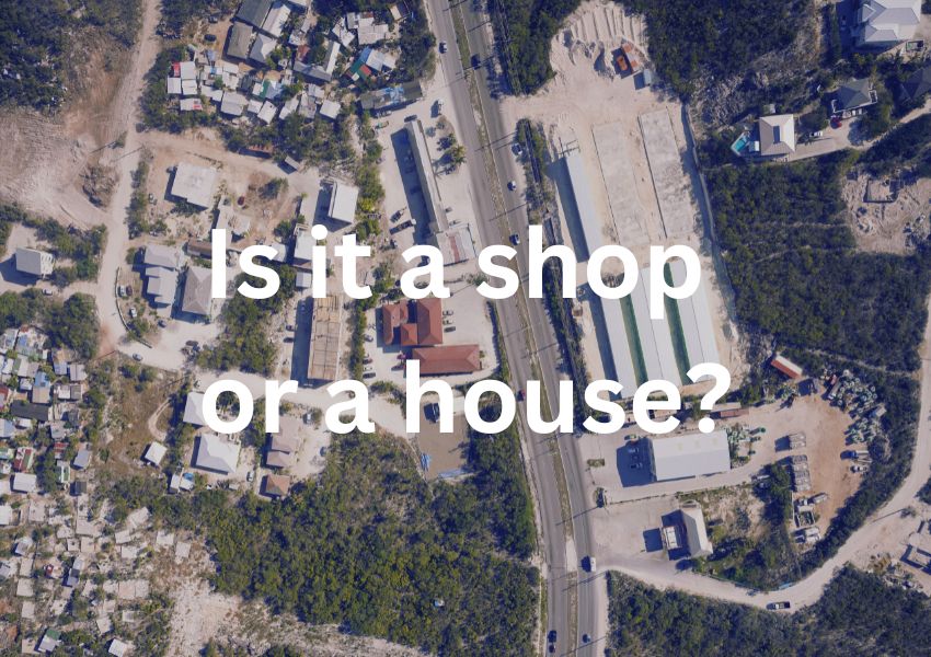
But how can images make a difference?
Mapping data is an integral part of the modern digital world and is critical to unlocking opportunities for sustainable growth, development and climate resiliency. Our images’ detailed resolution, along with its high positional accuracy, means it can be used in a broad range of initiatives that improve people’s lives.
Examples include providing resilient housing and essential public services, building roads and infrastructure, understanding and protecting against natural disasters, and managing and monitoring climate change.
How is PLACE's data different?
In addition to being held in a data trust for public benefit, our aerial imagery has an average Ground Sample Distance (GSD) of 5cm compared with 40-50cm for satellite imagery. This means that you can see and detect many details and features of a city that are too blurred in a typical satellite image.
MOVE THE SLIDER BELOW LEFT TO RIGHT to get an idea of the detail afforded by the resolution of PLACE Aerial by viewing Plateau Mosque in Abidjan.
PLACE Aerial vs Satellite image comparison, Abidjan
Product details
Providenciales International Airport, March 2023
PLACE Aerial
A collection of optical (RGB), nadir aerial images. An image collection is a set of individual images collected for area of interest e.g. a flight line, a project site or a city acquired with an Unmanned Aerial Vehicle (UAV). Images have an average GSD of 10 cm, a minimum forward overlap of 60% and a radiometric resolution of 24-bit (3 x 8 bits per band). Images are geo-tagged by means of carrier phase differential GNSS and exposure event marking, yielding fixed and float solutions with an average positional accuracy of 20 – 30cm. Image collections are delivered in JPEG format with associated metadata. For larger areas we collect imagery using aircraft.
Cockburn Town, Grand Turk, January 2023
PLACE Ground
A de-identified collection of optical (RGB), 360-degree terrestrial images. An image collection is a set of individual images collected along a route (e.g. an alley, street or road) with a 360 degree horizontal field of view without any gaps, using mobile mapping platforms with an on board GNSS, geo-tagged with a typical positional accuracy of between 2 and 5 meters at 4K resolution with faces and number plates blurred. Image collections are delivered in JPEG format with associated metadata.
Data Specifications
PLACE collects very high-resolution, optical aerial and high-definition, 360 degree street imagery for urban centres in Africa and small island states in the Caribbean and Pacific.
Our aerial imagery has an average Ground Sample Distance (GSD) of 5cm compared to 40-50cm for satellite imagery. This detailed resolution, along with its high positional accuracy means PLACE imagery can be used in a broad range of planning initiatives from civil and electrical engineering, property taxation, parcel mapping, asset inventories, point of interest mapping, population estimates to housing resilience and housing condition assessments.
We continue to see rapid improvements in platforms, software and methodologies that help PLACE and our partners collect PLACE Data from the air and street. Members such as IO Aerospace have equipped a Lear jet with the latest LIDAR and Ultracam Aerial cameras allowing 5000 sq km to be collected in a single hour, Blue Sky uses a range of aerial platforms and camera and lidar systems to map large areas efficiently. For smaller area collection, our current UAV platform of choice from Event38, is integrating the latest in frameless, bodyless 64MP cameras and increasing flight times of its eVTOL e400 platforms to close to two hours.
You can get an idea of the detail afforded by the resolution of PLACE Aerial by viewing Plateau Mosque in Abidjan. Use the slider control to compare the detail discernible on PLACE imagery (left) and satellite imagery (right):
Coverage
We have collected image data in Ghana, Cote D’Ivoire, Turks and Caicos, Anguilla, Malawi and Kenya with more geographies being added all the time.
To find out more about our ongoing data collection click on a story below and to browse PLACE’s current image collection please visit our Image Catalog.
Data Processing and Access
Image processing comprises tasks undertaken both in the field (or the edge) and the cloud. PLACE has implemented a hybrid cloud approach to process and manage the imagery it collects. Our public cloud uses AWS.
- PLACE Aerial imagery, collected by UAV, is post processed in the field. Data collectors perform carrier phase adjustment uploading a Post Processed Kinematic (PPK), or positionally corrected image collection. Images are checked to ensure, amongst other things they are geotagged and have sufficient overlap. Imagery is then made available to PLACE members. Members can search PLACE’s image catalog using a STAC browser requesting images that cover their area of interest. In cases where imagery is collected using aircraft the contractor post processes imagery on our behalf. These image collections are also added to our image catalog.
- PLACE Ground imagery is uploaded from the field for de-identification (faces and number plates are blurred). Imagery is then made available to Members. Members can search maps that show the routes where PLACE has collected street imagery, requesting images that cover their area of interest.