In late 2025, the Kingdom of Tonga embarked on a groundbreaking geospatial initiative in partnership with PLACE Foundation and the Pacific Community (SPC). This project aimed to capture high-resolution aerial and street-level imagery across Tongatapu and Ha’apai, laying the foundation for a national Digital Twin—a virtual representation of the islands to support land management, climate resilience, and infrastructure planning.
Why This Matters
Accurate geospatial data is critical for Tonga’s development. From urban planning and disaster preparedness to environmental stewardship, these datasets provide decision-makers with the tools to build resilient communities. The project also strengthens local capacity, ensuring Tonga’s GIS professionals can independently manage and utilize these advanced technologies.
The Mission
Over six weeks, the joint team captured:
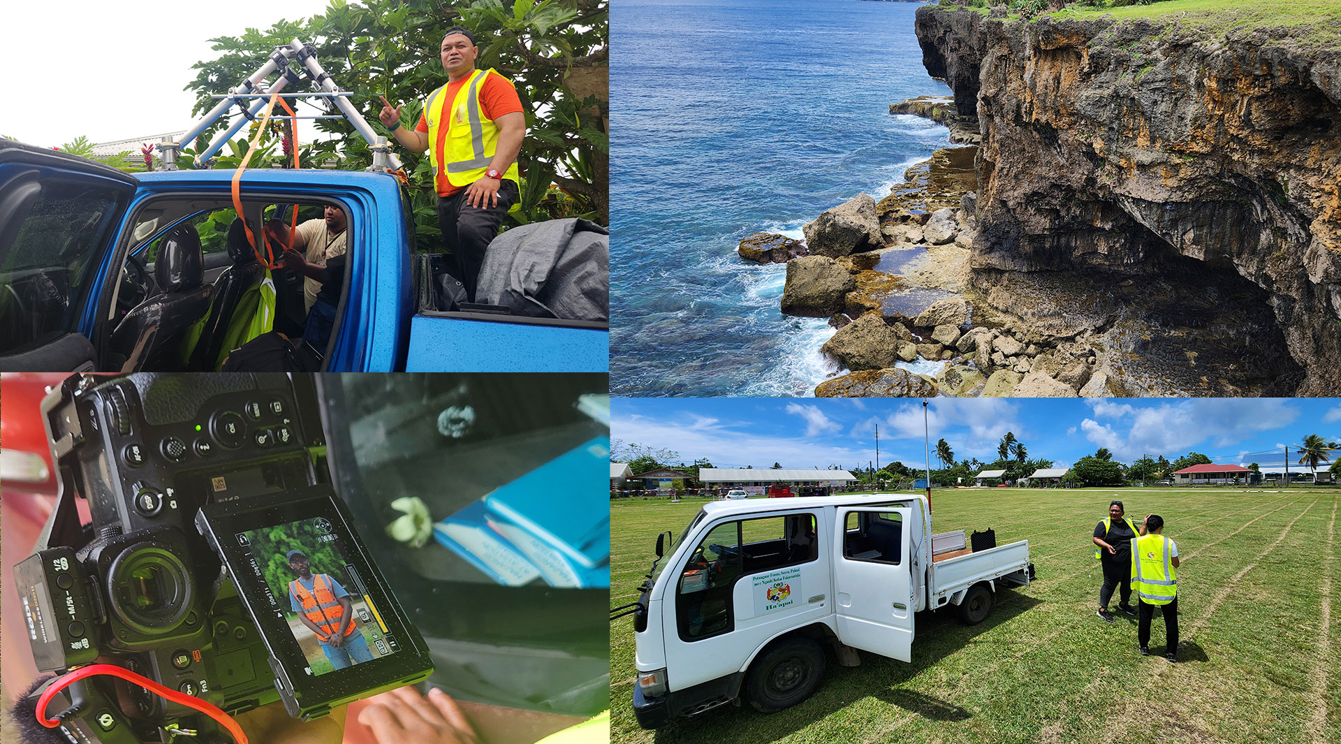
Aerial Imagery: 320 km² across Tongatapu and Ha’apai using fixed-wing UAVs, achieving resolutions of 5–10 cm GSD. This included 18,713 images for Tongatapu and 2,412 for Ha’apai.
Street-Level Imagery: 800 km of roads and paths documented with 360° cameras, producing over 190,000 exposure points for a detailed view of Tonga’s built environment.
The aerial campaign relied on the Quantum Systems Trinity Pro UAV, equipped with a 61 MP Sony sensor and GNSS for precision mapping. For ground capture, the team deployed the Mosaic 51 camera for Tongatapu and the Insta360 X5 for Ha’apai, ensuring comprehensive coverage even on narrow tracks and coastal paths.
Challenges and Adaptation
Fieldwork wasn’t easy. Heavy rains, low visibility, and even fuel shortages in Ha’apai disrupted operations. Strong coastal winds forced flight cancellations and adjustments. Despite these hurdles, the team adapted quickly, reorganizing plans and maximizing favourable weather windows to meet coverage goals.
What’s Next?
All collected data will be owned by the Government of Tonga to be integrated into national geospatial systems. A copy will be stored under the PLACE Trust in the UK. This initiative marks a significant step toward digital transformation, empowering Tonga to plan smarter and respond faster to environmental and developmental challenges.
Key Stats at a Glance
Aerial Coverage: 320 km² | 21,125 images | 5–10 cm GSD
Street-Level Coverage: 800 km | 198,825 images | 12K
Mission Duration: 6 weeks (extended due to weather)
This project is more than mapping—it’s about resilience, innovation, and empowering local expertise. Tonga now stands at the forefront of Pacific nations embracing geospatial technology for sustainable development.
Already a member of the PLACE Community? Access our PLACE Data here.
Not yet a PLACE Member, but interested in using the data? Contact us or join today, and check out the available imagery via our STAC.