

Why models trained in one place often struggle in another
Artificial intelligence is transforming how we understand and manage our world. It can help assess disaster damage, monitor urban growth, identify infrastructure needs, and support decisions about everything from climate resilience to land administration. As AI becomes more powerful, expectations for what it can do continue to grow. Yet many of the models driving this transformation suffer from a fundamental limitation: they have only learned from a small part of the world.
The datasets used to train many geospatial AI models are heavily concentrated in North America and Europe, while large parts of Africa, Latin America, the Caribbean, Southeast Asia, and the Pacific remain underrepresented. As a result, AI systems that perform remarkably well in one place can struggle the moment they are deployed somewhere else. The challenge is not that the models are poorly designed. The challenge is that the world is far more diverse than the data used to train them.
Consider a simple example. Flat concrete roofs are common throughout the Caribbean because they are designed to withstand hurricane-force winds. Yet AI models trained largely on North American imagery have sometimes classified these homes as parking lots because they do not resemble the residential structures the model learned to recognize. The model isn’t broken. It simply learned from a dataset where homes generally have pitched roofs, asphalt shingles, and suburban street layouts. When confronted with something different, it makes the best prediction it can based on what it knows.
The same problem appears across much of the world. A neighborhood in Lilongwe doesn’t look like a suburb in Virginia. Traditional homes in Malawi don’t resemble the structures that dominate most Western training datasets. Informal settlements in Abuja don’t follow the same patterns as planned communities in Arizona. The buildings are different. The materials are different. The settlement patterns, densities, vegetation, and infrastructure are different. When AI encounters environments it has never seen before, performance often begins to deteriorate.
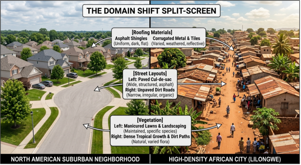
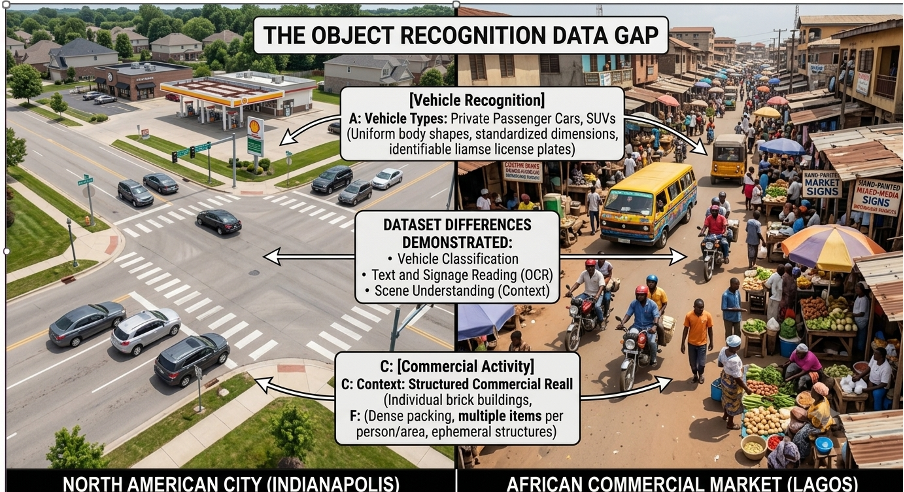
Researchers refer to this as a spatial domain shift, but the concept is straightforward. AI models learn patterns from examples. If the examples come primarily from one set of geographies, the model develops assumptions about what buildings, roads, infrastructure, and communities are supposed to look like. Those assumptions may work well in the environments represented in the training data. They become far less reliable when the model is asked to operate somewhere else.
This becomes a real-world problem the moment AI moves from the laboratory into operational use. If a model cannot reliably identify buildings in Malawi, it cannot effectively support post-disaster damage assessments in Malawi. If it cannot distinguish residential and commercial structures in Dhaka, it cannot help planners understand how a city is growing. If it cannot accurately map informal settlements in Abuja—where structures are densely packed, boundaries between buildings are often ambiguous, and construction materials vary block by block—it cannot help governments make informed decisions about infrastructure investment. A planning tool that cannot accurately interpret the built environment it is meant to serve is not much of a planning tool at all.
The same challenge extends beyond mapping and computer vision. Generative AI systems often reveal similar blind spots. Ask some image-generation models to create a street scene in Africa and the results can reflect a surprisingly narrow set of visual assumptions. Not because African cities are homogeneous, but because the training data often is. Cities such as Lagos, Nairobi, Accra, and Kigali are dynamic, modern, and diverse, yet AI systems sometimes struggle to represent that complexity because they have not been exposed to enough examples of it.
For years, conversations about bias in AI have focused on race, gender, language, and culture. Those discussions are important and necessary. But the geography of our training data may be one of the most overlooked sources of that bias. The bias is not in the world’s diversity—that diversity is real, and describing it, explaining why places differ and why people live where they do, is the work of geography itself. The bias is in datasets that capture only a fraction of that world, and in models that mistake one region’s patterns for a universal norm. After all, AI doesn’t just learn from people. It learns from places. And many of those places remain largely absent from the datasets shaping the next generation of intelligent systems.
That gap creates both a challenge and an opportunity. At PLACE, we work with governments and national mapping agencies to collect high-resolution aerial and street-level imagery in parts of the world that have historically been overlooked by the global geospatial data ecosystem. Our work spans countries across Africa, the Caribbean, the Pacific, and South Asia—regions where high-quality geospatial data is often limited but where the need for effective AI tools is growing rapidly. The data belongs to the governments we work with, and through the PLACE Trust, it can help support researchers, developers, and organizations building solutions for global deployment.
PLACE is not an AI company, and we do not build models. Our role is to help ensure that the people who build those models have access to data that better reflects the world those models are expected to serve. Increasingly, we are also working with partners to move beyond raw imagery and develop the derived datasets that make machine learning possible, including building footprints, land-use classifications, and infrastructure inventories. Imagery provides the foundation, but labeled data is often what accelerates model development.
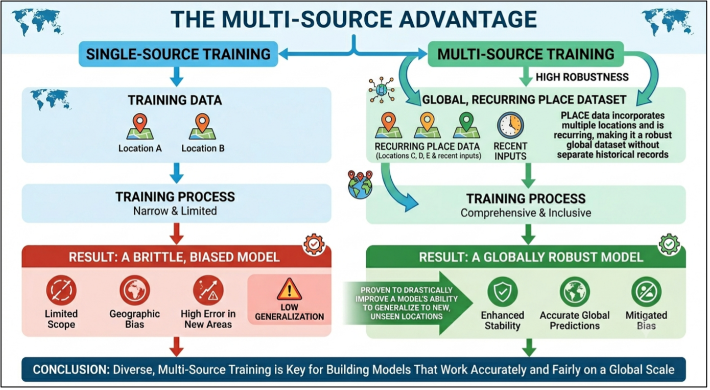
The evidence increasingly points in the same direction: models trained on geographically diverse data perform better when they encounter new places. A model trained exclusively on imagery from the Global North is often brittle when deployed elsewhere. A model trained on imagery from Virginia, Lilongwe, Abuja, and Tongatapu develops a broader understanding of what human settlements, infrastructure, and communities can look like. The goal is not to build a separate model for every country. The goal is to build stronger foundation models that are better equipped to understand the extraordinary diversity of the world.
The future of AI will certainly be shaped by bigger models, faster chips, and more computing power. But it will also be shaped by the quality and diversity of the data used to train those systems. If AI is going to help solve global challenges—from disaster response and climate adaptation to urban planning and infrastructure development—it must be capable of understanding the places where those challenges exist. Today, too much of that world remains underrepresented in the data. Closing that gap may be one of the most important—and most overlooked—steps toward building AI systems that work not just somewhere, but everywhere.