In 2025, PLACE partnered with the Government of St. Vincent & the Grenadines, with support from the World Bank, to deliver a national high-resolution mapping initiative designed to support smarter planning, stronger resilience, and more effective public services.
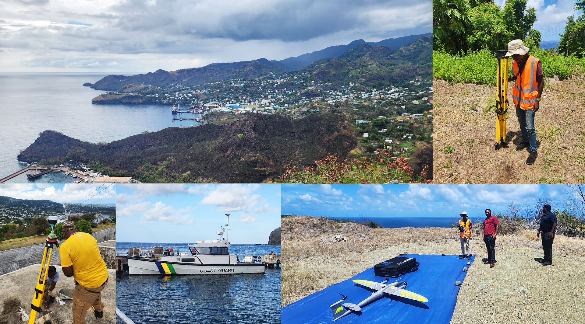
Working closely with the Lands & Surveys Department, PLACE captured comprehensive aerial and street-level imagery across St. Vincent and key Grenadine islands, including Bequia, Mustique, Union Island, Canouan, Mayreau, and Palm Island. The result is a current, consistent spatial foundation that can be used across land administration, infrastructure planning, environmental management, and disaster preparedness.
For island nations, reliable and up-to-date mapping data isn’t a luxury—it’s essential. St. Vincent & the Grenadines regularly faces hurricanes, flooding, and other natural hazards. Yet despite the eruption of La Soufrière in December 2020 and repeated storm events, much of the country had been relying on imagery more than two decades old. That gap made everything harder, from transport planning to climate adaptation and emergency response.
This project changes that.
PLACE delivered high-resolution aerial and street-level imagery across St. Vincent and multiple Grenadine islands, creating a practical, future-ready foundation for decision-making. Key outputs include:
- 236 km² of aerial imagery captured across 34 UAV flights at 5–10 cm resolution
- 550+ km of 360° streetlevel imagery covering primary and secondary road networks
- Digital orthophotos, DSMs, contours, slope and aspect layers
- Watershed and stream networks, a national 3D model, and GeoAIderived products including building footprints and land cover
Together, these datasets provide a shared, authoritative view of the country—one that supports faster analysis, clearer coordination across agencies, and better long-term planning.
This work reflects PLACE’s core mission: making timely, affordable, and reliable mapping available so governments can better serve their communities and plan with confidence for a more resilient future.
You can explore the PLACE data from St. Vincent & the Grenadines here.
Already a member of the PLACE Community? Access our PLACE Data here.
Not yet a PLACE Member, but interested in using the data? Contact us or join today, and check out the available imagery via our STAC.